
-
МјРЇСІИёСЖШИМі
-
 И№ОЫ КИОЫ Йъ ЗЛЦЎЧЯБт~ ИЎСЖЦЎ ПЙОрБюСі
 89,610
 -
 [ЧЪИЎЧЩ ММКЮ] ФЋИ№ХзНК ПЉЧр 100Йш СёБтБт
 49,792
 -
 ИЖДвЖѓ НУГЛ - ИЎРп АјПјСЄКИ. (ЛчСј 16Рх ЦїЧд)
 30,846
 -
 ММКЮРЧ СіПЊСЄКИ15,561
 -
 ИЖДвЖѓ БйБГ - ЕћАЁРЬЕћРЬ ПЉЧр СЄКИ14,402
 -
 [ЧЪИЎЧЩ ММКЮ/ИЗХК] ШЃХк МїЙк ПфБн Йз СЄКИ13,356
 -
 КИЖѓФЋРЬРЧ И№Еч И№НРРЛ КММі РжДТ ЛчСјУИ.13,167
 -
 ИЖДвЖѓ БйБГ - ЦХЛѓЧб ЦјЦї ПЉЧрСЄКИ12,868
 -
 [ММКЮ-ЙшМБТјРх] МБЙкШИЛч РќШЙјШЃПЁПф~12,494
 -
 ИЖДвЖѓ СіПЊ(ПЁИЃЙЬХИ -ИЛЖѓХз)РЧ СіЕЕ/ЧбБЙ РННФСЁ/МюЧЮИє12,146
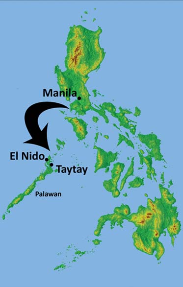
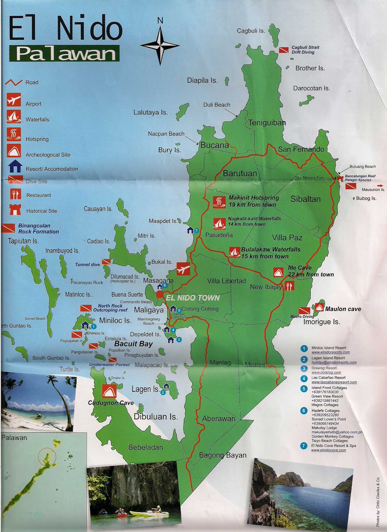
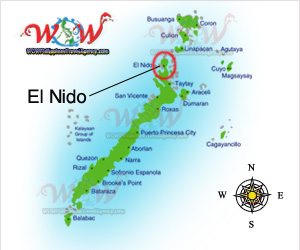
El Nido (officially the Municipality of El Nido) is a first class municipality and managed resource protected
areain the province of Palawan in the Philippines. It is about 420 kilometres (260 mi) southwest of Manila,and about
238 kilometres (148 mi) northeast of Puerto Princesa, Palawanтs capital.
Geography
The municipality, covering a land area of 465.1 square kilometres (179.6 sq mi)n the northernmost tip of
mainland Palawan, is bordered by the Linapacan Strait in the north, the Sulu Sea in the east, and the South China
Sea in the west. It is composed of 45 islands and islets,[each has its own unique geological formations. The
highest peak is at Cadlao Island, towering up to 640 metres (2,100 ft) above sea level.
Together with Sulu Archipelago, Sabah, and South China Sea, El Nido, being part of Palawan, is located in the
tectonically active and seismically active Sunda Plate,[7] a plate that is entirely separate from the Philippine Mobile
Belt to which the rest of the Philippines belongs. The Permian to Paleogene rocks and limestone cliffs of El Nido are
similar to those that can be found in Ha Long Bay in Vietnam, Guilin in China, as well as Krabi in Thailand, all of
which are part of the Sunda Plate.
History
El Nido has been inhabited by humans as early 2680 BC, or even up to 22,000 years ago.[9] This was confirmed by
the fossils and burial sites, dating back to the Late Neolithic Age, that can be found in many caves and excavation
sites surrounding the municipality, particularly the Ille Cave in New Ibajay. Chinese traders had been regularly visiting the area of El Nido for its edible birds' nests during the Sung Dynasty (960-1279 BC). In fact, El Nido is specifically
mentioned in Chinese records as far back 1225 BC. Caho Ju-Kua, a member of the Chinese Royal Family, Trade
Commissioner and Superintendent of Customs of the Port of Chuan How wrote about the island, Pa-Lao-Yu or Land of Beautiful Harbors in his book Chu Fan Chai.
The town traces its roots from a small Tagbanua village called Talindak. Some time in the 16th century, waves of
migrants from Cuyo Islands came here to settle. In the 1800s, the Spaniards arrived, and they moved to the part
where the present-day Población and Mabini are located.[4] The first Spanish families were the Canovas, Vázquez, Ríos and Rey. In 1890, the Spaniards renamed it as Bacuit. At the time, the center of the town was Cabigsing, then
known as Inventario. Chinese families moved into the area about the same period, first settling in Langeblangeban.
The first Chinese settlers were named Lim, Chin, Liao, Edsan, Ambao, Que-Ke, Lim Piao, Yu His, Pe Phan and Pe
Khen.
Government
El Nido is governed by a Mayor and a Vice Mayor, who are elected to three-year terms. The Mayor is the executive head and leads the municipality's departments in executing the municipal ordinances and improving public services. The Vice Mayor heads the legislative council consisting of 8 councilors, or more commonly known as Sangguniang Bayan members. The Municipal Council is in charge of creating the municipality's policies in the form of Ordinances and Resolutions.

El Nido is politically subdivided into eighteen barangays. Four of which are situated in the Población (town proper),
and are also known by their
- ЁЄ
- ЁЄ
- ЁЄ
- ЁЄ
- ЁЄryWvMVxeet
- ЁЄryWvMVxeet
- ЁЄryWvMVxeet\'\"\\(
- ЁЄryWvMVxeetщ\'\"\\(
- ЁЄryWvMVxeet
- ЁЄryWvMVxeet
- ЁЄryWvMVxeet
- ЁЄryWvMVxeet
- ЁЄryWvMVxeet
- ЁЄryWvMVxeet
- ЁЄryWvMVxeet


 ЧЪРкДхФФ ОпАЃЛѓДу ПРЧТ
 13ГтПЌМг МвКёРкИИСЗ 1РЇ

 ГЛАд ИТДТ ОюЧаПј УЃБт
 ИЎОѓ ЧаБГ ЙцЙЎБт
 СжИЛПЁ ГЛАЁ ОЕ КёПыРК?
 УжАэАЁМККё РЬКЅЦЎ СёБтБт
 ЧіСіПЁМЕЕ ЧЪРкДхФФ!
 ЧіСіПЁМ АЁДЩЧб


 ЧЪРк ЦЏБо Ч§ХУ! ФСНУОюСі МКёНК


