
-
МјРЇСІИёСЖШИМі
-
 И№ОЫ КИОЫ Йъ ЗЛЦЎЧЯБт~ ИЎСЖЦЎ ПЙОрБюСі
 89,611
 -
 [ЧЪИЎЧЩ ММКЮ] ФЋИ№ХзНК ПЉЧр 100Йш СёБтБт
 49,796
 -
 ИЖДвЖѓ НУГЛ - ИЎРп АјПјСЄКИ. (ЛчСј 16Рх ЦїЧд)
 30,847
 -
 ММКЮРЧ СіПЊСЄКИ15,561
 -
 ИЖДвЖѓ БйБГ - ЕћАЁРЬЕћРЬ ПЉЧр СЄКИ14,403
 -
 [ЧЪИЎЧЩ ММКЮ/ИЗХК] ШЃХк МїЙк ПфБн Йз СЄКИ13,357
 -
 КИЖѓФЋРЬРЧ И№Еч И№НРРЛ КММі РжДТ ЛчСјУИ.13,168
 -
 ИЖДвЖѓ БйБГ - ЦХЛѓЧб ЦјЦї ПЉЧрСЄКИ12,869
 -
 [ММКЮ-ЙшМБТјРх] МБЙкШИЛч РќШЙјШЃПЁПф~12,495
 -
 ИЖДвЖѓ СіПЊ(ПЁИЃЙЬХИ -ИЛЖѓХз)РЧ СіЕЕ/ЧбБЙ РННФСЁ/МюЧЮИє12,147
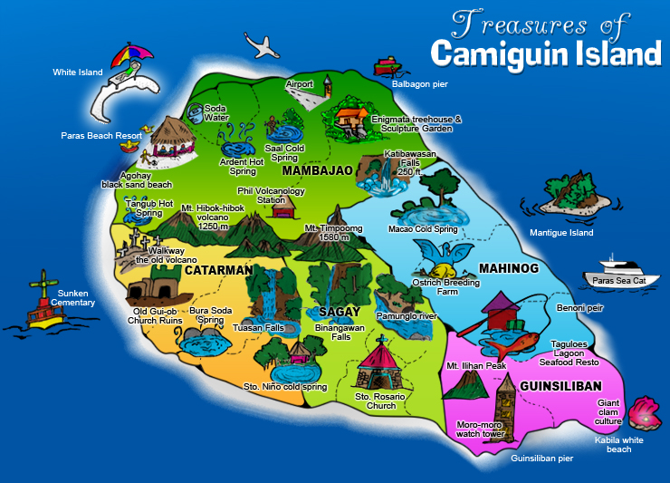
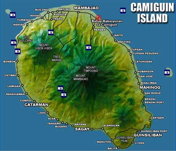
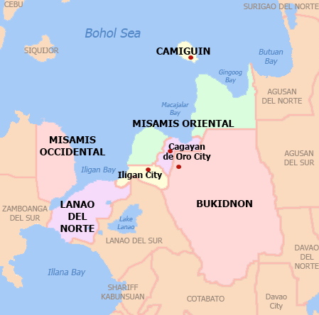
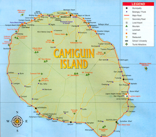
Camiguin Map
Camiguin is an island province of the Philippines located in the Bohol Sea, about 10 km (6.2 mi) off the northern
coast of Misamis Oriental in Mindanao. It is the second-smallest province both in population and land area
after Batanes. The capital of the province is Mambajao, and it is a part of the Northern Mindanao Region of the
Philippines.
The province of Camiguin is divided into five municipalities, the largest of which is Mambajao. Each towns are
subdivided into a total of 58 barangays. The five municipalities are Catarman,Guinsiliban,Mahinog,Mambajao
and Sagay.
The name Camiguin is derived from the native word тKamagongт, a species of the ebony tree that thrives near
Lake Mainit in the Province of Surigao del Norte. Earlier inhabitants of the islands are Manobos from the Surigao region. An earlier Spanish geography book writes the island as "Camiguing". There is reason to suppose the
Spaniards dropped the final.
On July 4, 1946, the country gained independence from the US and became the Republic of the Philippines.
The island of Camiguin was part of Misamis Oriental until 1958, when it became a sub-province.It was made
into a separate province on June 18, 1966, but was not formally inaugurated until 1968.
- ЁЄ
- ЁЄ
- ЁЄ
- ЁЄ
- ЁЄryWvMVxeet
- ЁЄryWvMVxeet
- ЁЄryWvMVxeet\'\"\\(
- ЁЄryWvMVxeetщ\'\"\\(
- ЁЄryWvMVxeet
- ЁЄryWvMVxeet
- ЁЄryWvMVxeet
- ЁЄryWvMVxeet
- ЁЄryWvMVxeet
- ЁЄryWvMVxeet
- ЁЄryWvMVxeet


 ЧЪРкДхФФ ОпАЃЛѓДу ПРЧТ
 13ГтПЌМг МвКёРкИИСЗ 1РЇ

 ГЛАд ИТДТ ОюЧаПј УЃБт
 ИЎОѓ ЧаБГ ЙцЙЎБт
 СжИЛПЁ ГЛАЁ ОЕ КёПыРК?
 УжАэАЁМККё РЬКЅЦЎ СёБтБт
 ЧіСіПЁМЕЕ ЧЪРкДхФФ!
 ЧіСіПЁМ АЁДЩЧб


 ЧЪРк ЦЏБо Ч§ХУ! ФСНУОюСі МКёНК


