
-
МјРЇСІИёСЖШИМі
-
 И№ОЫ КИОЫ Йъ ЗЛЦЎЧЯБт~ ИЎСЖЦЎ ПЙОрБюСі
 89,605
 -
 [ЧЪИЎЧЩ ММКЮ] ФЋИ№ХзНК ПЉЧр 100Йш СёБтБт
 49,773
 -
 ИЖДвЖѓ НУГЛ - ИЎРп АјПјСЄКИ. (ЛчСј 16Рх ЦїЧд)
 30,844
 -
 ММКЮРЧ СіПЊСЄКИ15,559
 -
 ИЖДвЖѓ БйБГ - ЕћАЁРЬЕћРЬ ПЉЧр СЄКИ14,398
 -
 [ЧЪИЎЧЩ ММКЮ/ИЗХК] ШЃХк МїЙк ПфБн Йз СЄКИ13,352
 -
 КИЖѓФЋРЬРЧ И№Еч И№НРРЛ КММі РжДТ ЛчСјУИ.13,165
 -
 ИЖДвЖѓ БйБГ - ЦХЛѓЧб ЦјЦї ПЉЧрСЄКИ12,865
 -
 [ММКЮ-ЙшМБТјРх] МБЙкШИЛч РќШЙјШЃПЁПф~12,489
 -
 ИЖДвЖѓ СіПЊ(ПЁИЃЙЬХИ -ИЛЖѓХз)РЧ СіЕЕ/ЧбБЙ РННФСЁ/МюЧЮИє12,144
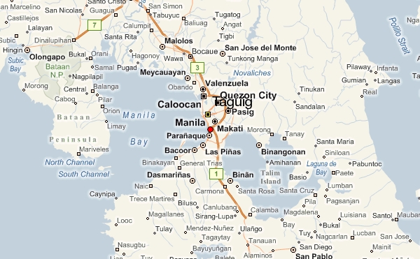
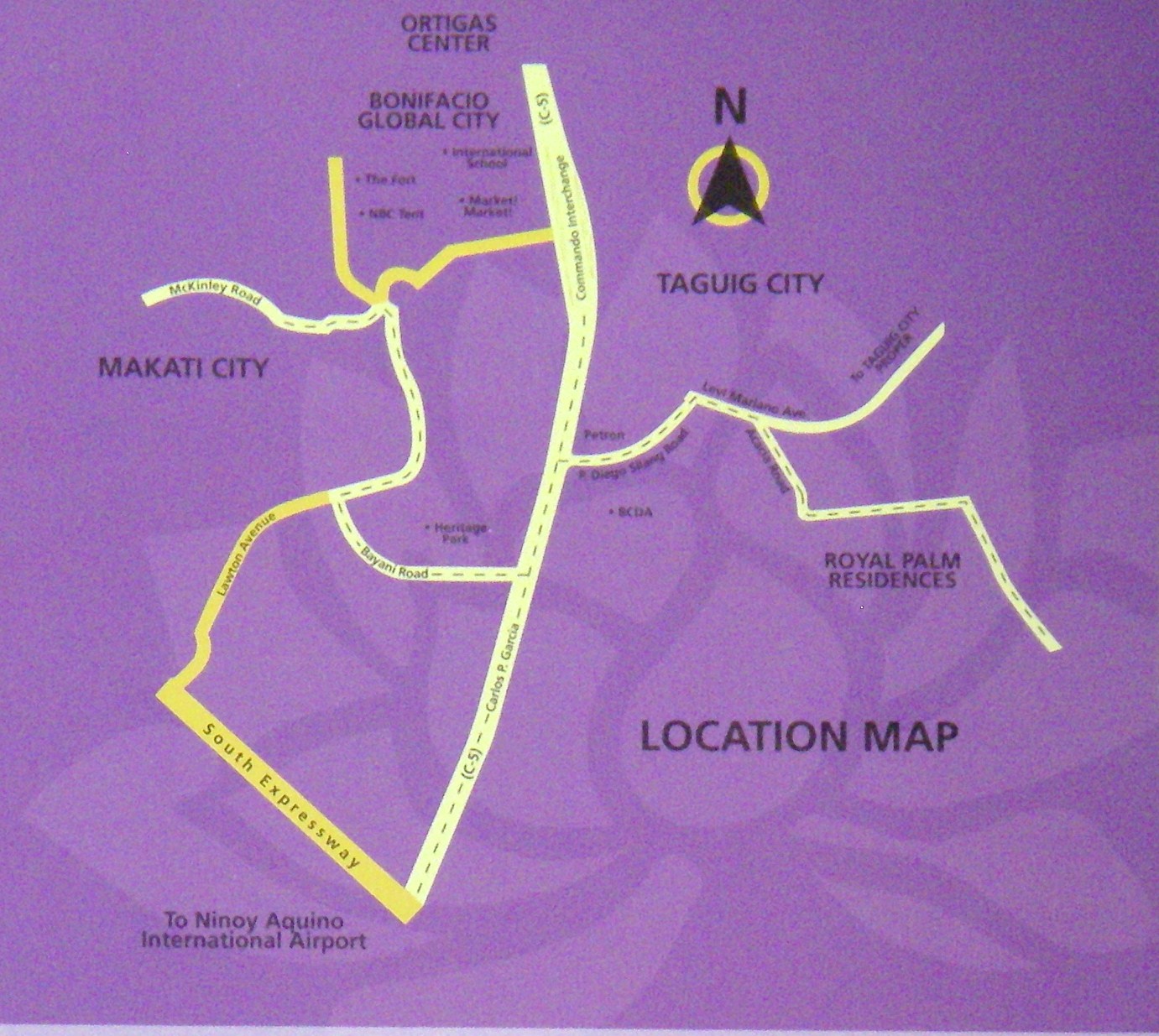
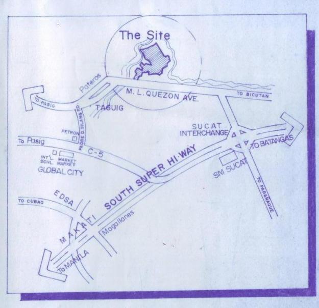
Taguig Map
Taguig (formerly spelled as Tagig; Filipino: Lungsod ng Taguig) is a city in Metro Manila in the Philippines.
From a thriving fishing community along the shores of Laguna de Bay, it is now an important residential,
commercial and industrial center. The recent construction of the C-5 highway and the acquisition of the Fort
Bonifacio development area has paved the way for the cityhood of the municipality. It is also accessed by the
future C-6 Road.
Taguig City lies on the western shore of Laguna de Bay and is bordered by Muntinlupa City to the south,
Paranaque City to the southwest, Pasay City to the west, Cainta and Taytay on the northeast and Makati City,
Pateros, and Pasig City to the north. Taguig River, a tributary of the Pasig River cuts through the northern half of
the municipality and Napindan River, also a tributary of the Pasig forms the common border of Taguig with
Pasig City.
The city ranked first among Philippine cities in the Ease of Doing Business Index, conducted by the World Bank's International Finance Corporation.
Before the Spaniards came, Taguig was a part of the Kingdom of Tondo ruled by Rajah Soliman. There were
also accounts that Chinese settlements were once present in the area as revealed by the recent archeological
diggings of various artifacts like cups, plates and other utensils, which bear Chinese characters. This was
believed to have originated from China's Ming dynasty.
Taguig was one of the earliest known territories to have been Christianized when the Spaniards succeeded in
subjugating mainland Luzon through the Legazpi expedition in 1571.
- ЁЄ
- ЁЄ
- ЁЄ
- ЁЄ
- ЁЄryWvMVxeet
- ЁЄryWvMVxeet
- ЁЄryWvMVxeet\'\"\\(
- ЁЄryWvMVxeetщ\'\"\\(
- ЁЄryWvMVxeet
- ЁЄryWvMVxeet
- ЁЄryWvMVxeet
- ЁЄryWvMVxeet
- ЁЄryWvMVxeet
- ЁЄryWvMVxeet
- ЁЄryWvMVxeet


 ЧЪРкДхФФ ОпАЃЛѓДу ПРЧТ
 13ГтПЌМг МвКёРкИИСЗ 1РЇ

 ГЛАд ИТДТ ОюЧаПј УЃБт
 ИЎОѓ ЧаБГ ЙцЙЎБт
 СжИЛПЁ ГЛАЁ ОЕ КёПыРК?
 УжАэАЁМККё РЬКЅЦЎ СёБтБт
 ЧіСіПЁМЕЕ ЧЪРкДхФФ!
 ЧіСіПЁМ АЁДЩЧб


 ЧЪРк ЦЏБо Ч§ХУ! ФСНУОюСі МКёНК


