
-
МјРЇСІИёСЖШИМі
-
 И№ОЫ КИОЫ Йъ ЗЛЦЎЧЯБт~ ИЎСЖЦЎ ПЙОрБюСі
 89,605
 -
 [ЧЪИЎЧЩ ММКЮ] ФЋИ№ХзНК ПЉЧр 100Йш СёБтБт
 49,773
 -
 ИЖДвЖѓ НУГЛ - ИЎРп АјПјСЄКИ. (ЛчСј 16Рх ЦїЧд)
 30,844
 -
 ММКЮРЧ СіПЊСЄКИ15,559
 -
 ИЖДвЖѓ БйБГ - ЕћАЁРЬЕћРЬ ПЉЧр СЄКИ14,398
 -
 [ЧЪИЎЧЩ ММКЮ/ИЗХК] ШЃХк МїЙк ПфБн Йз СЄКИ13,352
 -
 КИЖѓФЋРЬРЧ И№Еч И№НРРЛ КММі РжДТ ЛчСјУИ.13,165
 -
 ИЖДвЖѓ БйБГ - ЦХЛѓЧб ЦјЦї ПЉЧрСЄКИ12,865
 -
 [ММКЮ-ЙшМБТјРх] МБЙкШИЛч РќШЙјШЃПЁПф~12,489
 -
 ИЖДвЖѓ СіПЊ(ПЁИЃЙЬХИ -ИЛЖѓХз)РЧ СіЕЕ/ЧбБЙ РННФСЁ/МюЧЮИє12,144
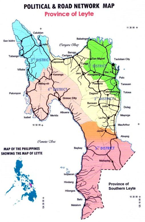
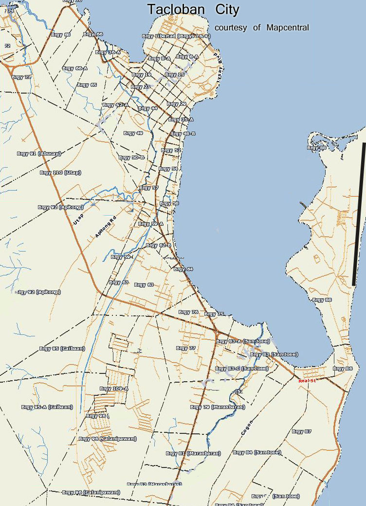
Tacloban Map
The City of Tacloban (Filipino: Lungsod ng Tacloban, Waray: Ciudad han Tacloban) is a port city approximately 360 miles southeast of Manila. It is the first in Eastern Visayas to be classified as a Highly Urbanized City. It is
the capital of the Philippine province of Leyte and is the largest city in terms of population[4] in Eastern Visayas. It is also considered as the regional center of the Region VIII. Tacloban was briefly the seat of the Philippine
Commonwealth Government, from October 20, 1944 to February 27, 1945.
In an extensive survey conducted by the Asian Institute of Management Policy Center and released in July 2010, Tacloban City was ranked among the top ten most competitive cities in the Philippines. Tacloban ranked fifth
overall, and second in the emerging cities category.
Tacloban was first known as Kankabatok, an allusion to the first inhabitants of the place ? Kabatok. They
established their dwelling in the vicinity of the present day Sto. Nino Church. Others who came later were
Gumoda, Haraging and Huraw who erected their own settlements in nearby sites. Hurawтs domain is the hill
where the city hall now sits. The combined settlements acquired the name Kankabatok, meaning Kabatokтs
property.
By the end of the 16th century, Kankabatok was under the political administration of Palo and part of the parish of Basey, Samar. It was discovered in 1770, by the Augustinian Mission, who were superseded by the Franciscans in 1813. During this period, Kankabatok was renamed to Tacloban.
Economy
World-class handicraftsIt is the regional center of commerce, tourism, education, culture, and government in the region. It has new malls, entertainment centers, and coffee bars around. Tacloban is now actually a rising City with many new investments coming to the city, like malls, call centers and etc.
- ЁЄ
- ЁЄ
- ЁЄ
- ЁЄ
- ЁЄryWvMVxeet
- ЁЄryWvMVxeet
- ЁЄryWvMVxeet\'\"\\(
- ЁЄryWvMVxeetщ\'\"\\(
- ЁЄryWvMVxeet
- ЁЄryWvMVxeet
- ЁЄryWvMVxeet
- ЁЄryWvMVxeet
- ЁЄryWvMVxeet
- ЁЄryWvMVxeet
- ЁЄryWvMVxeet


 ЧЪРкДхФФ ОпАЃЛѓДу ПРЧТ
 13ГтПЌМг МвКёРкИИСЗ 1РЇ

 ГЛАд ИТДТ ОюЧаПј УЃБт
 ИЎОѓ ЧаБГ ЙцЙЎБт
 СжИЛПЁ ГЛАЁ ОЕ КёПыРК?
 УжАэАЁМККё РЬКЅЦЎ СёБтБт
 ЧіСіПЁМЕЕ ЧЪРкДхФФ!
 ЧіСіПЁМ АЁДЩЧб


 ЧЪРк ЦЏБо Ч§ХУ! ФСНУОюСі МКёНК


